
The first maps show party control of districts located in Northern Virginia in 1993 compared to 2019. As you can see, in 1993, the Northern Virginia outer suburbs were almost pure “red,” whereas today it’s a see of blue in Arlington County, Alexandria, Fairfax County, Prince William County and much of Loudoun County (also, heading into Stafford County and Fauquier County). 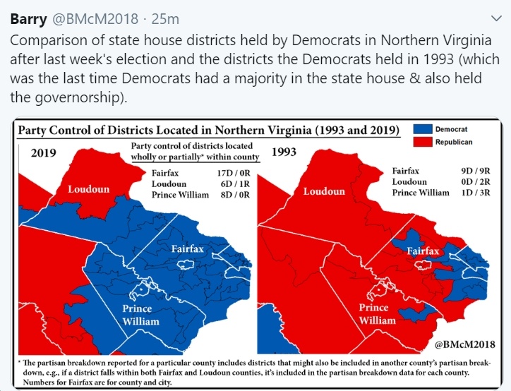 As the following tweet explains, in 1993, only 12 out the Democrats’ 52-district House of Delegates majority (23%) were from Northern Virginia, whereas today it’s 51% (28 out of 55 districts).